Transportation planning and traffic simulation software for creating cities friendlier to walking, biking, and public transit
Go to file
2021-09-04 10:43:14 -07:00
.github/workflows Upgrade to rust 1.54, fix new clippy warnings 2021-07-30 09:48:31 -07:00
abstio Allow routes to be saved in the bike network tool. #743 2021-09-03 12:23:58 -07:00
abstutil Automatically collapse more degenerate intersections. Manually tested 2021-08-02 12:06:47 -07:00
cloud Rewrite the heuristics for stop signs. Similar to traffic signals, only 2021-05-27 15:37:46 -07:00
collisions Fix compilation failures and most clippy warnings (#642) 2021-05-14 08:32:56 -07:00
convert_osm Move the cycleway snapping step to happen just before RawMap->Map, so we can play with it in the map_editor. #330 2021-07-27 11:20:57 -07:00
data Let the bike network tool's massive bottom right panel be minimized. Specialized an implementation just for this one case, not for Panels in general. 2021-08-30 10:58:16 -07:00
fifteen_min Adding a 'nearby houses and shops' feature to the bike network tool 2021-08-06 20:05:04 -07:00
game Drag-n-drop for waypoints! #743 2021-09-03 13:23:17 -07:00
geom Swap a femur with a tibia. A questionable trade, but I'm calling it 2021-08-05 18:51:19 -07:00
headless Some fixups to the regenerated data from the past two commits: 2021-07-05 17:51:40 -07:00
importer Start a tool to compress Map files by removing information unnecessary to the bike network tool. #746 2021-09-01 19:02:42 -07:00
kml CLI flag to start in the KML viewer for convenience 2021-06-16 11:14:17 -07:00
map_editor Don't crash in map_editor when we encounter overlapping OSM ways; skip that intersection and print loudly. 2021-09-04 10:43:14 -07:00
map_gui Followup to #742: Adjust name boundary0->center, fill out nice_map_name, upload map data for Lyon. 2021-08-29 08:21:02 -07:00
map_model Don't crash in map_editor when we encounter overlapping OSM ways; skip that intersection and print loudly. 2021-09-04 10:43:14 -07:00
osm_viewer Draw building driveways per zoomed-in road, rather than as one map-wide batch. Otherwise, every single edit to road width needs to redraw all driveways. This doesn't scale with larger maps! 2021-07-15 18:05:04 -07:00
parking_mapper Upgrade to Rust 1.53 2021-06-17 23:04:35 -07:00
popdat Don't crash in the activity model generators if a map has no borders. This currently happens with Overpass imports. #717 2021-07-25 10:30:06 -07:00
release Rebrand the tool, create new launch scripts for the binary release, 2021-08-25 16:52:43 -07:00
santa Santa was broken and nobody said anything! 2021-08-27 11:17:47 -07:00
sim Fix actdev crash -- some people in the imported scenario data don't have 2021-08-25 09:24:00 -07:00
tests Fix actdev crash -- some people in the imported scenario data don't have 2021-08-25 09:24:00 -07:00
traffic_seitan Add a debug tool to dump JSON for different objects and open up with an external viewer. [rebuild] [release] 2021-07-04 15:32:49 -07:00
traffic_signal_data Rewrite turn restrictions to handle collapsed roads. Lake Wash Blvd / Madison revealed this problem. 2021-08-03 00:07:49 -07:00
updater Import a new city using Overpass, instead of Geofabrik + clipping. #523 2021-07-12 14:06:54 -07:00
videos Delete mdbook. It's been split out to https://github.com/a-b-street/docs 2021-01-31 15:44:41 -08:00
web Only enter road editor from zoomed view. It's too easy to accidentally click while unzoomed. 2021-08-18 13:44:17 -07:00
widgetry Drag-n-drop for waypoints! #743 2021-09-03 13:23:17 -07:00
widgetry_demo Drag-n-drop for waypoints! #743 2021-09-03 13:23:17 -07:00
.dockerignore Create a Docker image to run the map importer in the almighty cloud. #326 2021-05-06 17:35:58 -07:00
.gitignore Adds fr/lyon 2021-08-29 08:12:47 -07:00
Cargo.lock Remove the experimental sumo import crate from early this year. It causes very slight technical debt (some public Map stuff) and there are no plans to do anything with this. The Sumo XML parser is always here in version control if it becomes interesting again later. 2021-09-01 19:23:13 -07:00
Cargo.toml Remove the experimental sumo import crate from early this year. It causes very slight technical debt (some public Map stuff) and there are no plans to do anything with this. The Sumo XML parser is always here in version control if it becomes interesting again later. 2021-09-01 19:23:13 -07:00
import.sh Two slight adjustments to speed up the map importer development 2021-06-24 12:13:47 -07:00
LICENSE Initial import of A/B Street prototype. 2018-03-13 08:06:03 -07:00
README.md new release 2021-08-26 13:06:45 -07:00
rgrep.sh Download only the cities specified in the UI map updater. 2021-04-19 17:55:42 -07:00

A/B Street

Ever been stuck in traffic on a bus, wondering why is there legal street parking instead of a dedicated bus lane? A/B Street is a game exploring how small changes to a city affect the movement of drivers, cyclists, transit users, and pedestrians. It works anywhere in the world, thanks to OpenStreetMap.

Show, don't tell

Alpha release trailer

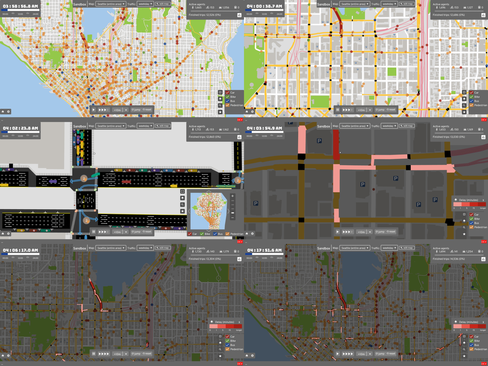
Find a problem:

exploring_traffic

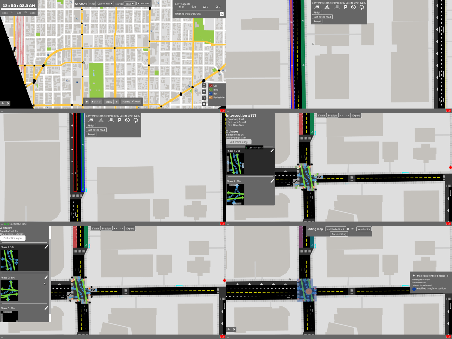
Make some changes:

editing_map

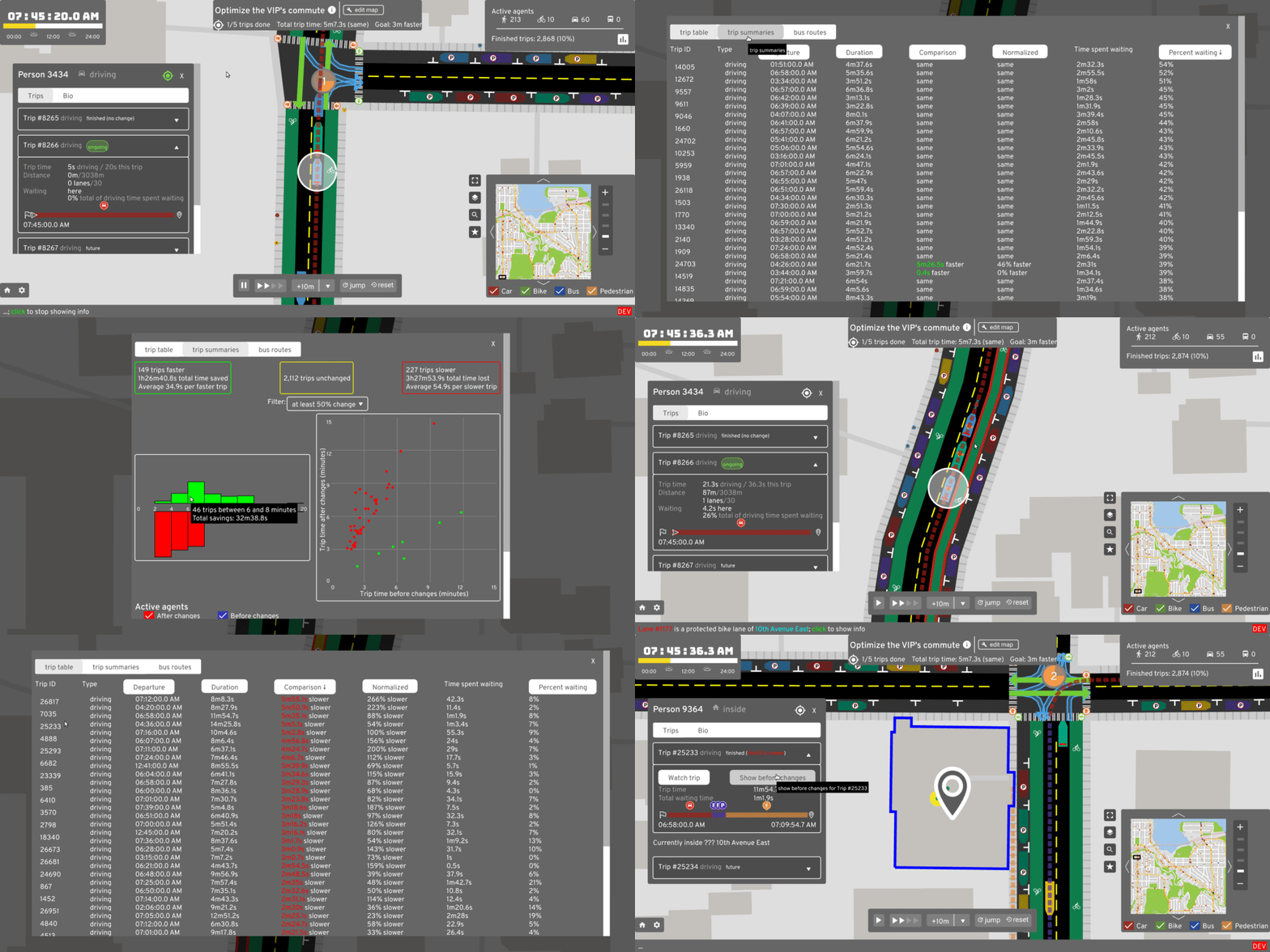
Measure the effects:

evaluating_impacts

Documentation

Roadmap and contributing

See the roadmap for current work, and all of the ways to contribute. Follow r/abstreet for weekly updates or @CarlinoDustin for occasional videos of recent progress.

Project mission

If you fix some traffic problem while playing A/B Street, my ultimate goal is for your changes to become a real proposal for adjusting Seattle's infrastructure. A/B Street is of course a game, using a simplified approach to traffic modeling, so city governments still have to evaluate proposals using their existing methods. A/B Street is intended as a conversation starter and tool to communicate ideas with interactive visualizations.

Why not leave city planning to professionals? People are local experts on the small slice of the city they interact with daily -- the one left turn lane that always backs up or a certain set of poorly timed walk signals. Laura Adler writes:

"Only with simple, accessible simulation programs can citizens become active generators of their own urban visions, not just passive recipients of options laid out by government officials."

Existing urban planning software is either proprietary or hard to use. A/B Street strives to be highly accessible, by being a fun, engaging game. See here for more guiding principles.

Credits

Core team:

See full credits