Transportation planning and traffic simulation software for creating cities friendlier to walking, biking, and public transit
Go to file
2022-11-08 10:16:39 +00:00
.github Upgrade to Rust 1.64. Specify workspace-level dependencies for some 2022-09-25 09:23:43 +08:00
abstio Remove old SRTM files entirely. Regenerate San Francisco without elevation yet; the results there aren't good enough to justify keeping the logic for this. #82 2022-11-03 12:18:46 +00:00
abstutil Refactor BinaryHeap ordering reverser 2022-10-26 14:25:12 +01:00
apps Import elevation data for the UK 2022-11-04 13:04:43 +00:00
cli Calculate driving side automatically, stop asking! 2022-11-08 10:16:39 +00:00
cloud Convert updater to structopt. #745 2021-11-01 12:46:57 -07:00
collisions Upgrade to Rust 1.64. Specify workspace-level dependencies for some 2022-09-25 09:23:43 +08:00
convert_osm Calculate driving side automatically, stop asking! 2022-11-08 10:16:39 +00:00
data Import a cross-borough area between Islington/Hackney 2022-11-04 14:03:10 +00:00
geom Completely rip out Osmosis polygon format stuff, use geojson instead. 2022-10-27 09:34:03 +01:00
headless Upgrade to Rust 1.64. Specify workspace-level dependencies for some 2022-09-25 09:23:43 +08:00
importer Calculate driving side automatically, stop asking! 2022-11-08 10:16:39 +00:00
kml Extract line-strings from GeoJSON and improve the extra shapes debug viewer a bit 2022-10-04 11:39:47 +01:00
map_gui Calculate driving side automatically, stop asking! 2022-11-08 10:16:39 +00:00
map_model Calculate driving side automatically, stop asking! 2022-11-08 10:16:39 +00:00
piggyback Fix mapbox demo. #1023 2022-11-07 09:46:18 +00:00
popdat Upgrade to Rust 1.64. Specify workspace-level dependencies for some 2022-09-25 09:23:43 +08:00
raw_map Update osm2streets: 2022-10-04 10:50:13 +01:00
release Try using ubuntu 20.04, to get binaries with an older glibc [rebuild] [release] 2022-08-28 18:59:56 +01:00
sim Refactor BinaryHeap ordering reverser 2022-10-26 14:25:12 +01:00
synthpop Upgrade to Rust 1.64. Specify workspace-level dependencies for some 2022-09-25 09:23:43 +08:00
tests Calculate driving side automatically, stop asking! 2022-11-08 10:16:39 +00:00
traffic_seitan Upgrade to Rust 1.64. Specify workspace-level dependencies for some 2022-09-25 09:23:43 +08:00
traffic_signal_data Upgrade to Rust 1.64. Specify workspace-level dependencies for some 2022-09-25 09:23:43 +08:00
updater Stop storing osm XML files in S3. 2022-10-26 16:18:33 +01:00
web Fix typos 2022-07-16 08:55:39 +01:00
widgetry Visualize how long to walk to the nearest crossing 2022-10-26 14:08:54 +01:00
widgetry_demo Refactor some more common crate dependencies with workspaces 2022-10-18 13:16:32 +01:00
.dockerignore Create a Docker image to run the map importer in the almighty cloud. #326 2021-05-06 17:35:58 -07:00
.gitignore Import Burnley 2022-11-04 10:26:39 +00:00
Cargo.lock Calculate driving side automatically, stop asking! 2022-11-08 10:16:39 +00:00
Cargo.toml Refactor some more common crate dependencies with workspaces 2022-10-18 13:16:32 +01:00
import.sh Split the importer into individual commands with structopt. #745 2021-10-25 13:02:00 -07:00
LICENSE Initial import of A/B Street prototype. 2018-03-13 08:06:03 -07:00
README.md new release 2022-10-31 19:08:16 +00:00
rgrep.sh Download only the cities specified in the UI map updater. 2021-04-19 17:55:42 -07:00

A/B Street

DOI

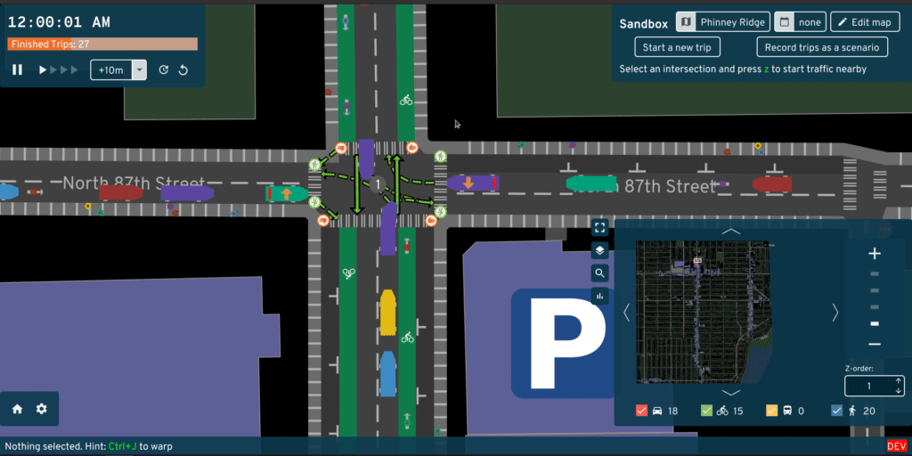
Ever been stuck in traffic on a bus, wondering why is there legal street parking instead of a dedicated bus lane? A/B Street is a project to plan, simulate, and communicate visions for making cities friendlier to people walking, biking, and taking public transit. We create software to simulate traffic, edit streets and intersections, plan bike networks, create low-traffic neighborhoods, and educate the public about 15-minute neighborhoods through games. The project works anywhere in the world, thanks to OpenStreetMap.

Videos

Documentation

Project mission

We amplify the efforts of individuals and advocacy groups who campaign to transition cities away from private motor vehicles. We believe in transparent and reproducible analysis, so all of our work is open source and based on public data. We believe everybody should have a voice in shaping their city, so our software aims to be easy to use.

Why not leave city planning to professionals? People are local experts on the small slice of the city they interact with daily -- the one left turn lane that always backs up or a certain set of poorly timed walk signals. Laura Adler writes:

"Only with simple, accessible simulation programs can citizens become active generators of their own urban visions, not just passive recipients of options laid out by government officials."

Existing urban planning software is either proprietary or hard to use. A/B Street strives to be highly accessible, by being a fun, engaging game. See here for more guiding principles.

Credits

Core team:

See full credits

Contact dabreegster@gmail.com or follow @CarlinoDustin for updates.